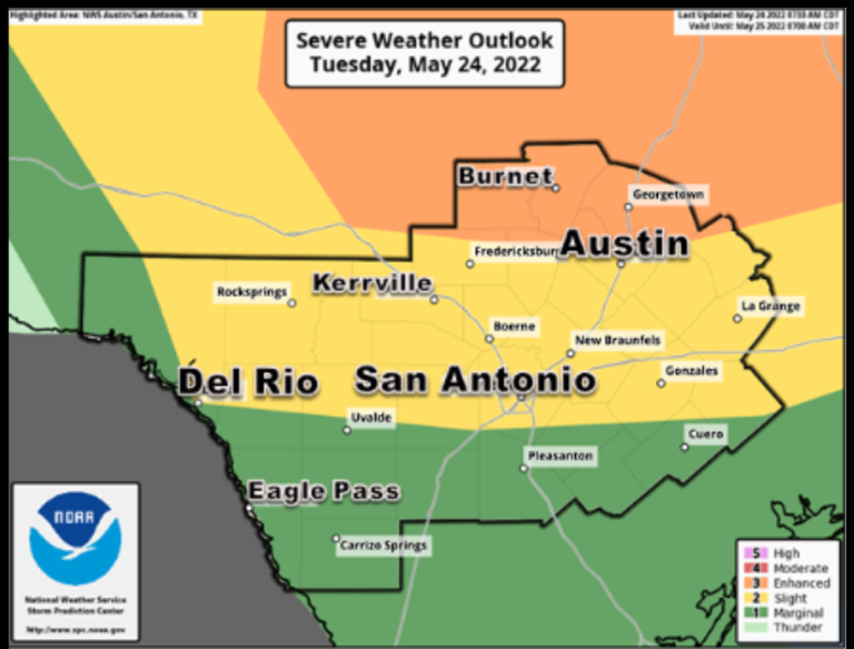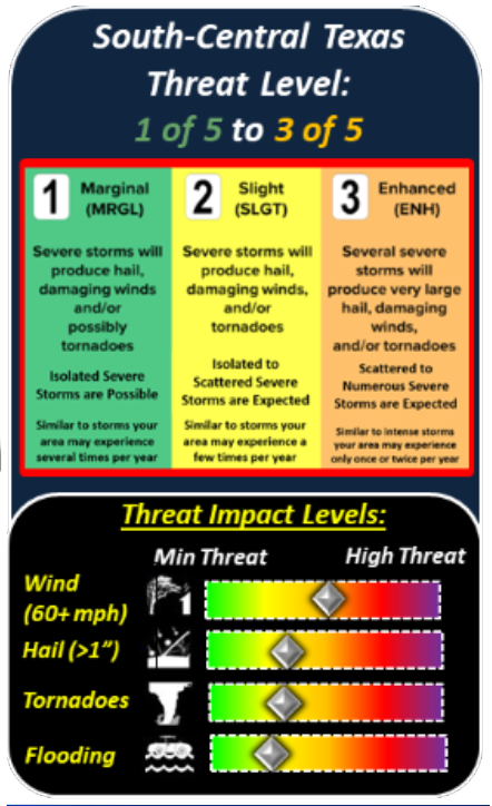


This hazardous weather outlook is for the following South-Central Texas Counties.
Llano – Burnet – Williamson – Val Verde – Edwards – Real – Kerr-Bandera -Gillespie – Kendall – Blanco – Hays – Travis – Bastrop – Lee – Kinney – Uvalde -Medina – Bexar – Comal – Guadalupe – Caldwell – Fayette – Maverick – Zavala – Frio – Atascosa – Wilson – Karnes – Gonzales – De Witt – Lavaca – Dimmit
It is becoming increasingly certain that a complex of showers and thunderstorms will impact South Central Texas late this evening through the overnight.
Some storms could become severe, producing large hail and damaging wind gusts. There is also a low chance of an isolated tornado or two.
The complex of storms is likely to bring pockets of locally heavy rainfall Tuesday night into Wednesday morning, which could lead to localized flash flooding of urban areas and small streams.
Showers and thunderstorms on Wednesday should remain mainly along and east of I-35.
There is a low chance for an isolated strong to severe storm to produce locally heavy rains and/or damaging thunderstorm wind gusts. Storms should exit to the east by the late afternoon.
The San Marcos City Council received a presentation on the Sidewalk Maintenance and Gap Infill…
The San Marcos River Rollers have skated through obstacles after taking a two-year break during…
San Marcos Corridor News has been reporting on the incredible communities in the Hays County…
Visitors won't be able to swim in the crystal clear waters of the Jacobs Well Natural…
Looking to adopt or foster animals from the local shelter? Here are the San Marcos…
The Lone Star State leads the nation in labor-related accidents and especially workplace deaths and…
This website uses cookies.