
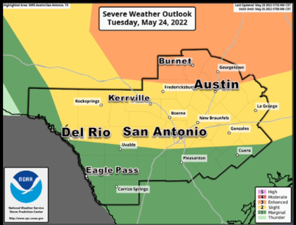
Severe storms heading toward South Central Texas tonight, tomorrow
DAY ONE…Today And Tonight.
 Isolated thunderstorms are possible during the day today, and there is a low chance for a strong storm during the afternoon primarily along the Rio Grande or near I-35.
This hazardous weather outlook is for the following South-Central Texas Counties.
Llano – Burnet – Williamson – Val Verde – Edwards – Real – Kerr-Bandera -Gillespie – Kendall – Blanco – Hays – Travis – Bastrop – Lee – Kinney – Uvalde -Medina – Bexar – Comal – Guadalupe – Caldwell – Fayette – Maverick – Zavala – Frio – Atascosa – Wilson – Karnes – Gonzales – De Witt – Lavaca – Dimmit
It is becoming increasingly certain that a complex of showers and thunderstorms will impact South Central Texas late this evening through the overnight.
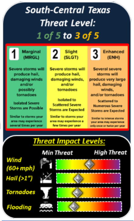
Some storms could become severe, producing large hail and damaging wind gusts. There is also a low chance of an isolated tornado or two.
The complex of storms is likely to bring pockets of locally heavy rainfall Tuesday night into Wednesday morning, which could lead to localized flash flooding of urban areas and small streams.
DAYS TWO THROUGH SEVEN…Wednesday through Monday.
Showers and thunderstorms on Wednesday should remain mainly along and east of I-35.
There is a low chance for an isolated strong to severe storm to produce locally heavy rains and/or damaging thunderstorm wind gusts. Storms should exit to the east by the late afternoon.


