
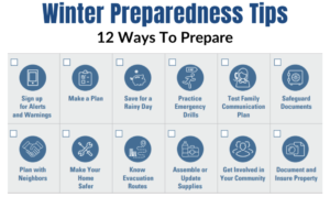
Hays County prepares for winter storm
A Winter Storm Watch has been issued for Hays County Feb. 3-5
Sierra Martin | Managing Editor
The National Weather Service is predicting a very strong arctic cold front will move through Central Texas starting Wednesday afternoon and evening bringing freezing temperatures; the coldest temperatures we have seen so far this winter.
A wintry mix of freezing rain and sleet could occur across portions of the area by Wednesday at midnight and continue until Thursday at 5 p.m. In parts the our area, freezing rain and sleet could cause travel delays on Thursday morning and continue through the day. Up to ¼ of an inch of ice is currently expected.
According to the National Weather Service, winds could gust as high as 35 mph and produce wind chill values in the single digits and teens Thursday through Friday night. Travel could be very difficult on untreated roads, especially elevated bridges, overpasses, and roadways. Pavement will be slippery to walk on. In addition, a risk for hypothermia exists for those spending extended time outdoors and not dressed in layers and gloves.
In addition to preparation information on Haysinformed.com, the county has warming centers strategically located in the county to provide warmth, food and water in the event of a massive power outage in the county.
 The Hays County Transportation Department will be staged in key areas of the county ready to sand roads which may present potential hazardous conditions.
Residents should plan to wrap and insulate outside faucets, take care of pets (bring them indoors during freezing weather) and have enough food, water and resources on hand to prevent unnecessary travel Thursday-Saturday.
The county suggests that residents check on their neighbors, particularly those who may need help with winter preparations, having enough food and water, etc.