Analysis: Changing Redistricting Rules Could Change Who Texas Sends To Congress — Dramatically
Texas lawmakers have shown time and again that their preference is for maps that protect incumbents and the political parties in charge. To get different results, you’d have to change the rules of redistricting.
Ross Ramsey
![]()
Drawing clever political districts is one way politicians in Texas and elsewhere avoid accountability — by protecting themselves from voters who disagree with them. They do this by stuffing weirdly shaped geographic districts with voters who agree with them.
A new examination of redistricting shows how effective legislators have done that nationally — and in Texas, and how changing the rules for drawing political maps could dramatically change who represents you at the state and federal Capitols.
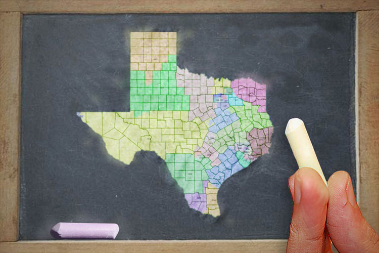
FiveThirtyEight unleashed a fascinating series of maps for their Gerrymandering Project series Thursday as the U.S. Supreme Court considers several cases that could solidify or disrupt redistricting practices in Texas and other states. In two closely watched cases, the court is deciding whether it’s possible — as a matter of law — to draw political districts that are so partisan they strip voters of their constitutional rights.
The data-centric news site crunched the numbers and lines and devised seven different ways to draw congressional maps for all 50 states: maximizing Republican seats; maximizing Democratic seats; matching each district’s partisan lean to that of the state overall; maximizing the number of highly competitive seats; drawing the greatest possible number of seats with minority-majority populations; drawing the most compact districts possible, using a computer algorithm; and drawing the most compact districts possible while crossing county lines as few times as possible.
They also offered up a full explanation of how they did it. It’s worth noting that they make no claims as to the legality of their maps — whether federal judges would approve of either their assumptions or the results.
What’s really interesting is how each set of new rules would change the maps.

Under maps currently in use, Texas has 25 Republicans and 11 Democrats in its 36-member congressional delegation (plus two Republican senators). The state has one true swing seat — the 23rd Congressional District, where U.S. Rep. Will Hurd, R-Helotes, is the incumbent. In its Texas analysis, FiveThirtyEight puts another district — the 32nd, in the Dallas area — on its list of districts that either party could win at least one time in six. U.S. Rep. Pete Sessions, R-Dallas, has held that spot since 1997.
Those lines were originally drawn by a Republican-majority Legislature and are still being litigated in federal court. The Texas case will be argued before the U.S. Supreme Court later this year.
The current map is not far from what FiveThirtyEight’s ideal Republican map would produce: 25 Republican seats, 10 Democratic seats and one swing district.
Give the ball to Democrats and you’d get a big flip: 20 Democrats, 15 Republicans and one swing seat.
It makes a difference who’s in charge of the crayons when it comes time to draw.
Taking the tools away from the partisans and following the political lean of the overall Texas electorate would put 21 Republicans, 14 Democrats and one swing district on the congressional map. Looking at just statewide races contested by both major parties, Republicans won 56.3 percent of the vote in 2016, and 59.2 percent in 2014, based on election records kept by the Texas Legislative Council.
If competition is your thing, FiveThirtyEight has one map that puts 22 congressional districts in Texas within reach of either the Republicans or the Democrats, leaving 10 solidly Republican seats and 4 solidly Democratic seats.
Their version of a map that maximizes the number of minority-majority seats has 10 Democratic districts, 18 Republican districts and 8 highly competitive districts.
The compact-district algorithm produces the simplest-looking map. As with the others, the design is required to include the same number of Texans in each district, so sparsely populated districts are big and dense, urban districts are small. And the algorithm wasn’t designed to take county lines into account; federal judges really like county lines. That said, the map has 20 Republicans, 10 Democrats and 6 highly competitive districts.
The map that is both compact and that keeps the county-line crossings to a minimum isn’t as elegant looking, but produces the same numbers: 10 Democrats, 6 swing seats and 20 Republicans.
Of the eight maps, the state’s current maps ranked third on FiveThirtyEight’s list of most partisan. Republicans could squeeze one more sure seat out of a partisan map, and Democrats could flip the whole state to make an unfair map that favors them. The two fairest maps, in terms of giving one or the other party an advantage? The one that’s proportional to the state’s overall partisan climate, and the one that draws the maximum number of highly competitive seats.
Texas lawmakers have shown time and again that their preference is for maps that protect incumbents and the political parties in charge. To get different results, you’d have to change the rules of redistricting.
This story originally published by The Texas Tribune.