Austin Police Continue Focused Enforcement On K2 – Synthetic Cannabinoid Dealers
Austin Police Department patrol officers and members of the Organized Crime Narcotics Conspiracy Unit continue to target K2 (synthetic cannabinoid) dealers who are preying on our community.
An investigation that began in December 2018 recently resulted in 16 warrants being issued for K2 dealers following lab confirmation of the drugs.
While awaiting lab results from that investigation, the APD Organized Crime Narcotics Team followed up on information provided by downtown Austin Police Department patrol officers earlier this summer and began an investigation into large-scale sales of K2.
Detectives identified a suspect with ties to Houston (a known source for K2) who was staying at a hotel near downtown. Further investigation linked that suspect to a partner who assisted with K2 distribution.
On June 25, 2019, members of the Narcotics Conspiracy Team set up surveillance and caught one of the suspects selling K2 “sticks” (similar in appearance to a marijuana cigarette) to multiple subjects in the downtown area.
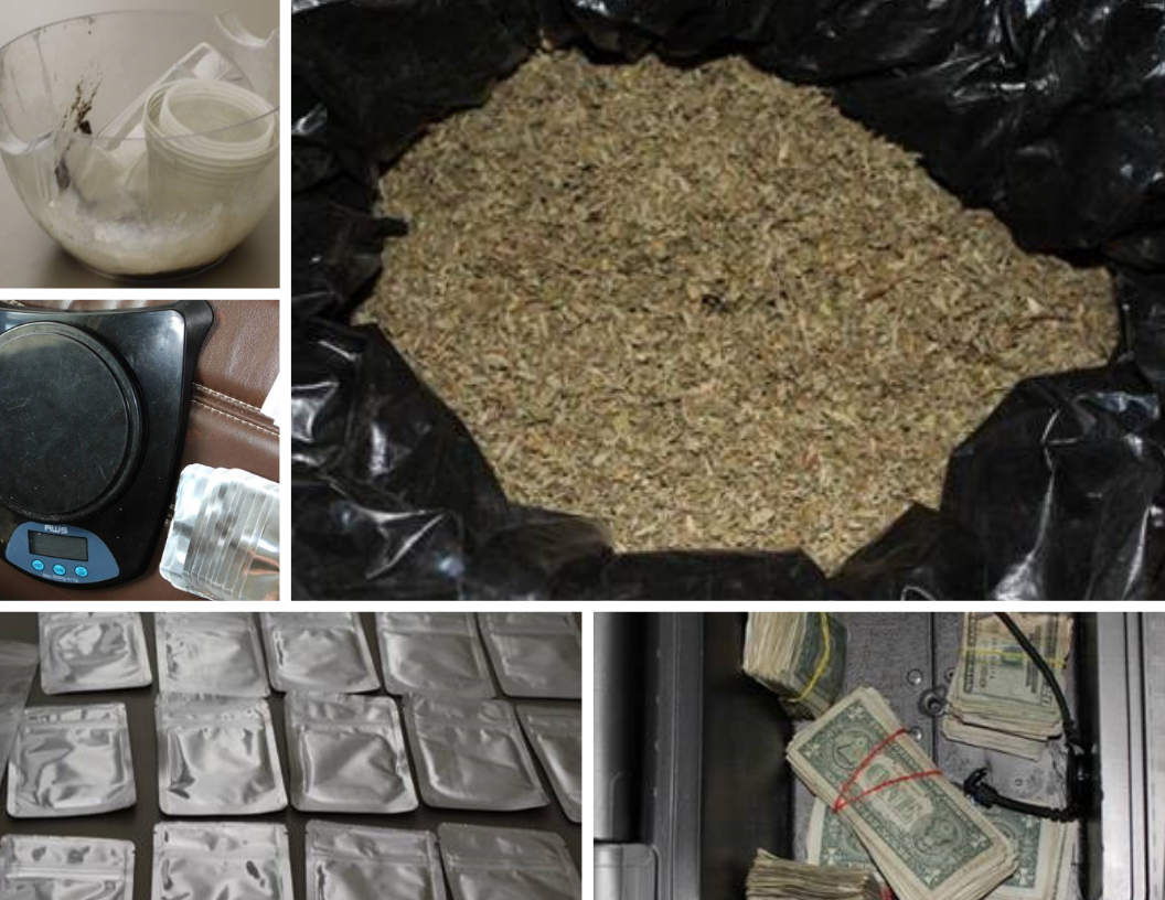
The suspect was detained and found to be in possession of several bags of K2. Based on that evidence and information previously gathered, detectives executed search warrants on two hotel rooms where they seized a large amount of additional K2, untreated damiana leaf (the leaf upon which the intoxicant is sprayed), flavoring, packaging, mixing equipment, scales and shipping forms from China.
The evidence indicates the suspects are receiving large amounts of raw materials to manufacture, package and distribute in the Austin area.
This ongoing case is a joint effort among APD, the Austin DEA Office and Houston Police Department Narcotics.
Anyone with information about either of these cases or similar cases is asked to call Crime Stoppers at 512-472-TIPS (8477) or text “Tip 103” + your message to CRIMES. You can also submit tips by downloading APD’s mobile app, Austin PD, for free on iPhone and Android or contact the APD Narcotics hotline at 512-974-8609.


